Tag Archives: map

WoodCut Maps and the Dymaxion Projection

I recently stumbled across this old article about the Dymaxion world map projection invented by Buckminster Fuller (and therefore also known as the Fuller Projection Map). It is supposedly the “first two-dimensional map of the entire surface of Earth that reveals our planet as one, without inaccurately distorting or splitting up the land”. You can buy a poster of it here.

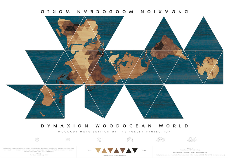
A team made up of artist Nicole Santucci and San Francisco-based firm Wood Cut Maps won the Dymax Redux prize to best show off this unique map projection on the 70th anniversary of its invention.

Source: Dezeen

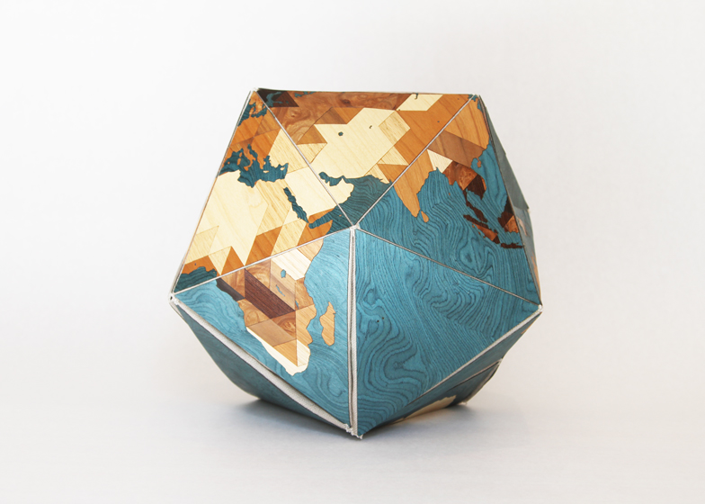
Their entry, Dymaxion Woodocean World, can be shown in the photos above and below. It shows the density of woodland throughout the world by using different colours of wood.

Source: Dezeen

I was intrigued by the concept, and realised that Woodcut Maps offer custom maps for sale!

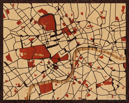
You can pick a spot on the map, have the site automatically create a rendered image suitable for manufacture, then have a woodcut map made of your selected spot. See my creation below based on the marvellous city that is London.

Source: woodcutmaps.com

Comparing Google Plus Codes with what3words

Geocoding systems are essentially software address systems that assign labels to geographic locations in order to improve navigation and the processing of locational data.

Apparently, around 50% of the world’s population doesn’t have a formal physical address, which is a barrier to the access of banking, mail, and emergency services. This is clearly, therefore, an extremely important problem to be solved.

There are lots of different types of these systems, but two notable examples are Google Plus Codes and what3words.

Google Plus Codes

Google Plus Codes, also known as Open Location Code (OLC), was designed by Google’s Zurich Engineering office.

The system assigns each location a short code that is used alongside the name of the settlement or prefixes it with another short string of characters. For example, Nelson’s Column on Trafalgar Square is either GV5C+4R Central London, UK or 9C3XGV5C+4R).
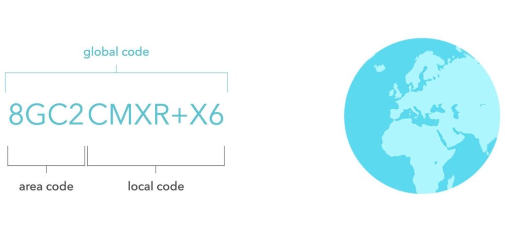
There is a great post by the creators of Plus Codes that evaluates the different “location encoding systems” and explains the rationale behind Plus Codes here.

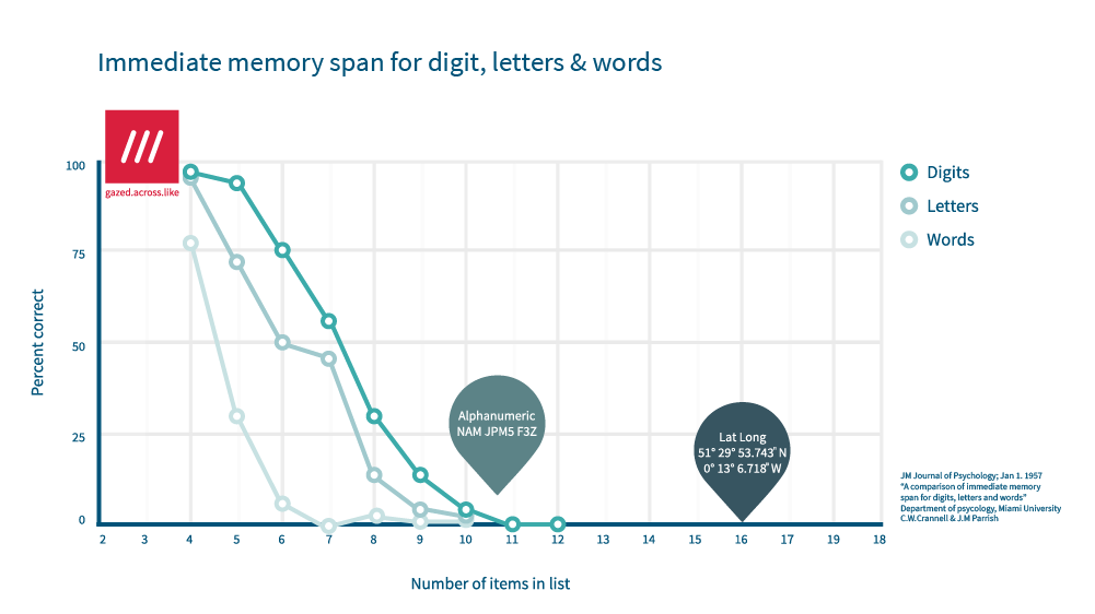
The main benefit of OLC is that it is a free, open source system. However, a big negative for me is that it is extremely hard to memorise that many characters (see graph below to illustrate the point). I also find it confusing that there is both a long version and a short version of each address point.

what3words

what3words (w3w) is a system developed by a London-based startup of the same name that divides the world into 3×3 meter squares and assigns each one a unique 3-word identifier. In this system, Nelson’s Column is life.swung.pounds.

To use what3words requires paying to get access, so I do wonder whether this will limit the adoption rate compared to Plus Codes which has been opened up to the developer community.

However, the beauty of w3w is that the use of only three words makes it super-user friendly and memorable (see graph below).

There are some minor challenges: for example, two locations next to each other will have totally different codes, so you can’t look at two codes and understand if they are close or not. However, they are vastly outweighed by the user-friendly nature of having only 3 words to remember.
Conclusion

I think that the what3word system is a phenomenal tool and usage will grow exponentially over the next 10 years due to its simplicity.

I personally think that Google Plus codes, although a great invention and one with potential uses, will struggle to get adopted by everyday users in the same way.

One thing that intrigues me though. Could what3words make more money by making the entire address system available for free to everyone and then charging for services around it? It would be fascinating to play with the financial model there!
Roman Roads as a Tube map

I’m a big fan of maps and I’m currently enjoying a spell of learning about Roman history (The History of Rome podcast by Mike Duncan is a particular treat).

You can imagine my excitement when I saw these maps of road networks in the Roman world made in the style of the London Underground or “Tube” map.

Produced by Sasha Trubetskoy in the USA, this one of the Roman road network in the UK is an absolute beaut:

Roman Roads of Britain

He has also produced this one of the major road network across the Roman world:

Roman Roads

Finally, here is his map of the Roman road network in Roman Italy:

Roman Roads of Italy

Great fun for the map nerds among us!

Radio Garden: cool map app showing global radio

Today I found an amazing little app courtesy of Mike Sutton. The app is called  Radio Garden.

Radio Garden shows a 3D model of the globe with green dots representing all the radio stations in that place, which you can then click to pick a station to listen to.

It is a project from Studio Puckey, an “experimental interactive design practice” based in Amsterdam, the Netherlands.

Radio Garden main interface (source: Studio Puckey)

Why is it cool?

Radio Garden is the confluence of three of my main interests: maps, music, and travel.

I love that you can instantly learn about a place that interests you by scrolling to the location and listening to the different radio stations there. It is literally a meeting point for all of the world’s voices.

For example, today I have listened to: a Malian dance station, Gambian pop, and a Scots Gaelic talk show from Stornoway in the Hebrides. How amazing is that?

Future of the app

My biggest concern is whether Studio Puckey can they monetise it in order to keep it alive for the future.

Could they get referral revenues for driving traffic to sites? Offer merchandise or ticket sales via the app? Perhaps just some simple adverts that are shown in a way that doesn’t adversely affect the user experience?

Whatever the route forward, I hope they figure out a way to make it financially sustainable to operate in the long term.